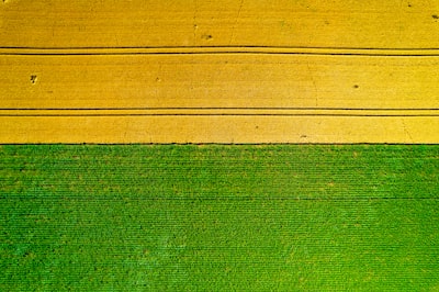
Precise delimitation of agricultural parcel boundaries is a challenge that combines computer vision, remote sensing, and operational need. While satellites like Sentinel-2 offer free coverage with 10-meter resolution, this scale proves insufficient for small parcels typical of family farming in developing countries, where many do not exceed 0.5 hectares. In such cases, a single 10-meter pixel can cover half a parcel, generating errors of up to 18 meters at the edges.
To overcome this limitation, the scientific community has turned to higher-resolution images, such as those provided by the PlanetScope constellation, which offers data at 3 meters per pixel. The recent release of the Fields of the Planet (FTP) dataset marks a milestone: it pairs the same polygons, seasonal windows, and training partitions as its predecessor Fields of the World (FTW) with 133,168 georegistered PlanetScope image patches, covering 24 countries. Evaluated using panoptic quality (PQ) metrics, F1 per object, PQ stratified by size, and coincident edge error at metric scale, the results are compelling: with the same architectures and training recipes, the 3-meter resolution raises PQ from 21.0 to 35.5, PQ in fields smaller than 0.5 ha from 5.8 to 15.7, and reduces edge error from 18.6 m to just 7.4 m.
This advancement not only improves accuracy but enables concrete applications: crop monitoring, irrigation planning, and yield estimation at the parcel level. Behind these models are artificial intelligence techniques such as convolutional neural networks and visual transformers, which require massive data processing. This is where software engineering and cloud infrastructure play a decisive role. Q2BSTUDIO, as a company specialized in AI for businesses, offers solutions that integrate these algorithms into productive workflows, from satellite image ingestion to the generation of vector maps.
To deploy a global-scale parcel mapping system, a robust platform is needed that combines AWS and Azure cloud services for elastic storage and computing, geospatial databases, and automation pipelines. It is also key to have custom applications that allow agronomists to visualize and validate results, as well as dashboards with business intelligence services and Power BI to monitor performance indicators. Q2BSTUDIO develops custom software that connects these components, including AI agents that iteratively refine segments and assist in anomaly detection. Furthermore, cybersecurity is a critical aspect when handling sensitive agricultural property data; our firm integrates security protocols at every layer of the system, from authentication to communication encryption.
Ultimately, mapping parcel boundaries at 3 meters represents a qualitative leap for precision agriculture. But for this scientific knowledge to translate into operational tools, a multidisciplinary approach is required where artificial intelligence, software development, and cloud infrastructure converge. Q2BSTUDIO accompanies agricultural organizations, governments, and startups on this path, offering comprehensive solutions ranging from model implementation to the deployment of scalable systems.