
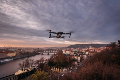
In the era of unmanned aerial vehicles (UAVs), reliance on GNSS systems (GPS, GLONASS, etc.) has become a critical vulnerability. When the satellite signal is lost or interfered with—in dense urban environments, natural canyons, or electronic warfare scenarios—drones lose their absolute position reference, drifting dangerously due to the drift of visual-inertial odometry. To solve this problem, the scientific community has explored alternatives such as location by reference images, but the raw visual appearance is fragile in the face of changes in lighting, season, angle of view, age of the map and even differences between optical and radar sensors.
Here a more robust approach emerges: semantic localization. Instead of comparing pixels or surface visual features, the persistent elements of the environment are represented: roads, buildings, bodies of water, train tracks, intersections, and field boundaries. This information is much more stable over time and in the face of disturbances. The conceptual framework known as SASGeo (Semantic And Structural Geolocation) proposes to align raster semantic maps, use relational graphs of geographical elements, evaluate the stability of features and their geographical distinctiveness, and apply a weighting system of positive, contradictory and unknown observations, all accompanied by an integrity-based rejection mechanism to avoid ambiguous fixations.
This approach is not a mere architectural proposal; In a reproducible proof-of-concept with 220 randomized trials that included rotations, scale changes, partial clippings, occlusions, simulated map alterations, and complex semantic decoys, global semantic descriptors reached 58.6% of Recall@1, while semantic geometric pairing variants reached 94.5-95.5%. Although Wilson's confidence intervals overlap between geometric variants, the experiment demonstrates that structured semantic geometry discriminates locations under controlled perturbations, with the next step being to address problems of aliasing, map aging, and rejection of ambiguous fixations.
What does this imply for the development of commercial or military UAV systems? That the key is not to have more visual data, but to model geographical knowledge so that the drone can interpret the world as a human pilot would: recognizing a road junction, a large lake or a characteristic roundabout. To implement these solutions in real-world environments, a combination of artificial intelligence is required to extract image semantics (semantic segmentation of aerial scenes), geographic database engines, and fusion systems with inertial navigation. This is precisely the kind of challenge that q2bstudio addresses with its enterprise AI services, developing custom software that integrates computer vision models with geospatial data pipelines.
Semantic localization isn't just relevant for drones. It also finds application in mobile land robotics, autonomous driving and navigation of rescue vehicles in environments without satellite coverage. In all these cases, the key is to build custom applications that convert sensor data (cameras, LiDAR, radar) into robust semantic representations, and then compare them with reference maps previously loaded or updated in real time using AWS and Azure cloud services. For example, an infrastructure survey drone can contrast the road network it observes with an OpenStreetMap map, identify the exact intersection and correct its drift thanks to a geometric matching algorithm. All of this computing can be run at the edge or delegated to the cloud depending on the required latency, and q2bstudio offers hybrid architectures with business intelligence services to monitor system performance and detect anomalies in localization processes.
A critical aspect is the cybersecurity of these systems. A UAV that receives map updates from the cloud or shares its estimated position is vulnerable to fake map injection attacks or signal spoofing. Therefore, any commercial implementation must include data integrity mechanisms, authentication of cartographic sources and encryption of communications. Q2bStudio includes cybersecurity modules in its projects to shield the data channel between the drone and the base station, as well as to ensure the storage of semantic maps in the cloud.
The future of autonomous navigation lies in the convergence of semantics and geometry. The AI agents operating these vehicles must be able to reason about the environment at a conceptual level, not just a numerical one. For example, an officer might infer that if he sees a three-lane highway with a concrete median, and the map indicates that there is a highway with those characteristics in that area, the probability of being at that point is high, even if the lighting is at night or foggy. This reasoning is implemented with fuzzy logic, Bayesian networks or spatial attention models, all of which can be trained with synthetic and real data. The ability to generate these tailor-made software solutions is at the core of q2bstudio's value proposition: transforming academic concepts into reliable and scalable products.
For companies developing delivery, precision agriculture, or surveillance drones, adopting a semantic location system is a competitive advantage. It reduces reliance on expensive differential GNSS receivers and increases robustness in harsh conditions. In addition, it allows the reuse of existing cartographic maps, such as cadastre, infrastructures or those generated by satellites, without the need to create massive visual databases. Integrating these capabilities into onboard systems requires a deep understanding of artificial intelligence architectures, real-time processing, and geospatial data management.
Q2bStudio, as a custom application development company, has implemented semantic localization solutions for clients in the logistics and defense sector, combining semantic segmentation models with vector databases in the cloud. In one of the pilot projects, it was possible to reduce the position drift of a drone indoors (where there is no GNSS) from 5 meters to less than 0.3 meters using only the lines of corridors and doors extracted from a floor plan. This type of result shows that semantics is the way.
Of course, the challenge of generalization remains open. Academic experiments such as the one described in the arXiv article:2607.07737v1 show that semantic geometry outperforms global descriptors, but real-world flight tests with extreme lighting conditions, changing vegetation, or outdated maps are still pending. The research community and companies must collaborate to create reference datasets that include multiple stations, camera angles, and heterogeneous sensors. Only in this way will it be possible to train models that distinguish between a real intersection and a similar one but located miles away (the problem of aliasing).
In this context, Power BI tools and business intelligence services can play an unexpectedly useful role: they allow you to visualize the quality of semantic fixations over time, detect areas with high uncertainty and feed dashboards for tactical decisions. For example, a drone fleet operator can see in real-time which aircraft are using semantic localization with high confidence and which need to be recalibrated. This approach to business intelligence applied to navigation is one of the added values that q2bstudio offers its clients, integrating AI agents that not only locate, but also learn from experience and improve their semantic maps dynamically.
Semantic localization for non-GNSS UAVs is not a laboratory fantasy; It's a technological reality that's maturing rapidly. With technology partners like q2bstudio, companies can make the leap from conceptual research to operational implementation, reducing risk and accelerating time-to-market. Custom software, artificial intelligence, the cloud and cybersecurity are the pillars on which this new generation of autonomous navigation is built. SASGeo is just the beginning; The real value is in transforming semantic data into accurate decisions.
