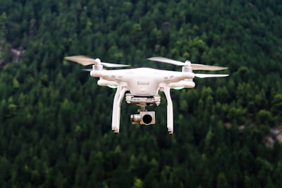
In modern armed conflicts, the ability to obtain accurate intelligence in real time can make the difference between a successful operation and a costly failure. Drones have democratized surveillance, but the real challenge is not in capturing images, but in transforming that torrent of data into useful information for decision-making. This is where a technology that is redefining the battlefield emerges: three-dimensional digital twins built from aerial imagery, capable of operating even when GPS is blocked or interfered with.
This article discusses how these 3D models are built in real time, the technical challenges involved, and the lessons that other industries—from logistics to civil engineering—can draw from this approach. In addition, we'll explore how software development companies like Q2BSTUDIO are helping organizations adopt similar architectures for their own environments, whether military, enterprise, or emergency response.
The first major obstacle in creating a 3D twin of the battlefield is the reliance on GPS. In conflict zones, satellite navigation signals are targeted by electronic attacks: they become saturated, spoofed or simply rendered useless. A reconstruction system that assumes precise coordinates fails miserably. The solution involves visual correlation techniques and reference to alternative data – such as base maps or known control points – that allow the images to be georeferenced without depending on GNSS. This approach requires robust image processing algorithms and machine learning models capable of aligning frames to each other even when the position is uncertain.
Once the location problem is overcome, the next challenge is speed. The 3D reconstruction pipeline should run in minutes, not hours, because the information loses value if it arrives after the target has been moved. This involves optimizing every stage: from ingesting video from multiple drones, to extracting characteristic points, to generating textured meshes and centimeter-accurate orthophotos. This is where techniques such as real-time photogrammetry and the use of GPUs to speed up calculations come into play. Companies that develop custom applications for demanding environments know well that computational efficiency is as critical as accuracy.
The 3D twin itself is just the foundation. Genuine intelligence emerges when that model is combined with automated detection of objects, anomalies, and changes. For example, comparing two models of the same area taken at different times allows you to identify vehicle movements, excavations or temporary installations. AI systems for companies trained with real data from the theater of operations achieve much higher success rates than generic ones, because the training context is identical to the deployment context. This feedback loop—users themselves report false positives, and the model is retrained—accelerates continuous improvement in a way that peacetime labs can hardly replicate.
But it is not enough to have intelligence if it does not reach those who need it. Three-dimensional visualization is key: a 2D map doesn't convey the sense of depth, slope, or line of sight that an immersive 3D model allows. That's why modern platforms integrate interfaces for virtual reality glasses, tablets, and control systems such as ATAK. Planning an approach route, simulating the field of view from a position or practicing the assault on a building are tasks that become intuitive in a 3D environment. These types of applications require robust cross-platform development and cloud servers capable of streaming heavy models to mobile devices in real time. The combination of AWS and Azure cloud services with lightweight frontends is a common architecture that companies like Q2BSTUDIO implement for their customers, ensuring scalability and low latency.
Another challenge that is not visible to the general public is the management of the communications link. A drone that loses the control signal in an area with obstacles can fall or be captured. Therefore, before sending an unmanned vehicle, the propagation of the radio signal on the ground is modeled, taking into account buildings, hills and trees. This radio coverage map route planning capability is a feature that rarely exists in commercial software, but is essential for missions in harsh environments. From a cybersecurity perspective, these systems must be protected against spoofing and jammer attacks, which adds an additional layer of complexity.
Behind this entire technological ecosystem is a need to integrate data from multiple sources, from video sensors to radars and electronic intelligence signals. The business intelligence applied here translates into dashboards that merge information from different sources and present it in a way that is understandable to commanders. Tools such as Power BI allow you to build these dashboards when the data comes from structured databases, but in field environments it is often necessary to develop custom software solutions that capture unstructured data (images, flight logs) and correlate it with tactical information. This is precisely the type of projects in which Q2BSTUDIO brings expertise, combining data analysis, process automation and deployment in cloud infrastructure.
The most important lesson we can draw from these developments is that technology is not neutral: the context in which it is created determines its architecture. Systems built under operational pressure tend to be lighter, more fault-tolerant, and easier to upgrade on the fly. That same mindset applies to civilian sectors: from the inspection of critical infrastructure (bridges, pipelines) to natural disaster response, where every minute counts and connectivity is not guaranteed.
In short, building a real-time 3D twin from drones isn't just a photogrammetry issue; it is a systemic challenge that encompasses GPS-less geolocation, high-performance computing, artificial intelligence, immersive visualization, and communications planning. Organizations that want to adopt similar capabilities—whether for defense, logistics, or emergency management—need technology partners who understand these complexities and know how to translate them into operational solutions. Q2BSTUDIO, with its expertise in AI agents, cloud integration and critical application development, is a partner capable of meeting these challenges, offering not only technology, but the in-depth knowledge of how to make it work when it matters most.