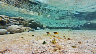
The exploration of the seabed remains one of the great challenges of modern science and technology. Accurately mapping benthic habitats – i.e. ecosystems that thrive on the ocean floor – is essential for biodiversity conservation, sustainable management of fisheries resources and underwater infrastructure planning. However, the lack of annotated and multimodal datasets has for years slowed down the advancement of artificial intelligence models capable of automating this task. In this context, the appearance of BenthiCat, a massive opto-acoustic dataset for benthic classification and mapping, represents a qualitative leap: it combines nearly one million side-scan sonar (SSS) tiles with bathymetric maps and optical images obtained by autonomous underwater vehicles (AUVs). Of those tiles, approximately 36,000 have manual segmentation masks, which allows you to train and fine-tune classification models with a level of detail never seen before.
But beyond the numbers, what is really transformative about BenthiCat is its multimodal approach. By cross-referencing acoustic data with optical imaging and bathymetry, possibilities are opened up for self-supervised learning and sensor fusion, two areas where industry and academia have been looking for robust solutions for years. A system that learns to recognise posidonia meadows, rocky bottoms or soft sediments by combining signals of different kinds is not only more accurate, but also more resilient to adverse conditions (turbidity, low lighting or acoustic noise). And this is where specialized technology companies can make a difference. For example, at Q2BSTUDIO we develop custom applications that integrate AI models with heterogeneous data pipelines, making it easier for research organizations and marine companies to adopt these datasets without having to build everything from scratch.
From a technical point of view, working with a resource like BenthiCat involves handling huge volumes of georeferenced information, which requires scalable cloud infrastructure. AWS and Azure cloud services offer on-demand compute power to train deep learning models with thousands of tiles, plus durable storage and orchestration tools. In our experience, combining these platforms with good data design (data lakes, metadata catalogs) allows experiments to be reproduced and results to be shared efficiently, which is critical when working with open datasets such as BenthiCat that seek to establish a standardized benchmark.
Artificial intelligence applied to benthic mapping is not limited to image classification. AI agents can automate tasks such as detecting changes in habitat over time, identifying invasive species, or generating risk maps for underwater infrastructure. Imagine a system that, fed with the opto-acoustic dataset, is able to suggest priority areas for conservation or warn about possible impacts of trawling. Such solutions require not only accurate algorithms, but also strong domain knowledge and custom software development that ensures integration with geographic information systems (GIS) and tracking dashboards. In Q2BSTUDIO, for example, we implemented dashboards with Power BI that visualize model predictions in real time, allowing marine biologists and managers to make data-driven decisions without needing to be AI experts.
Another crucial aspect is cybersecurity. Benthic habitat data may have strategic value for defence, resource exploitation or the protection of marine protected areas. A repository like BenthiCat, although public, must be handled with caution: access APIs, training pipelines, and field-deployed models must be protected against unauthorized access, malicious data injections, or adversary attacks. For this reason, in our projects we incorporate cybersecurity and pentesting services to audit both the cloud infrastructure and the applications that consume the dataset. An AI platform for enterprises that processes underwater imagery must meet safety standards by design, especially if the results are used for environmental certifications or regulatory reporting.
From a business perspective, BenthiCat opens up a range of opportunities. Oil exploration companies, environmental consultancies, precision aquaculture startups, or even offshore wind farms need detailed maps of the ocean floor. Having a reference dataset allows you to create AI for companies that solve specific problems: locating pipelines, assessing the impact of dredging, monitoring the regeneration of artificial reefs or planning submarine cable routes. And we are not just talking about static classification models; AI agents can act autonomously on board AUVs, making real-time decisions about which areas to sample or how to adjust the route based on the acoustic data collected.
The availability of open-source preprocessing and annotation tools that come with BenthiCat also lowers the barrier to entry. However, to scale these solutions to an industrial level, you often need custom software that automates workflows: from downloading and cleaning tiles to periodically retraining models with new data. At this point, AWS and Azure cloud services are once again the protagonists, as they allow MLOps pipelines to be deployed with automatic scaling, dataset versioning, and model drift monitoring. Without a solid architecture, a dataset of millions of images can become a liability rather than an asset.
As for integration with business intelligence systems, it's not just about visualizing maps. Companies operating in the marine environment need to correlate habitat data with oceanographic (temperature, salinity, currents) and economic (operating costs, fishing yield) variables. A dashboard in Power BI that combines benthic classification predictions with catch time series can reveal patterns that optimize fishing seasons or reduce environmental impact. At Q2BSTUDIO we know that every client has unique needs, which is why we offer bespoke applications that customise both AI algorithms and business reports.
Finally, it is worth reflecting on the future of benthic cartography. BenthiCat is a first step, but the trend is toward AI agents that not only classify, but also plan AUV trajectories, merge real-time data from multiple sensors, and communicate with surface control centers. For this to be possible, a technological ecosystem is required that brings together robust hardware, scalable software and models trained with rich datasets like this one. From our experience in developing AI solutions for enterprises, we see that the key lies in the collaboration between data scientists, marine domain experts, and software engineers. Only in this way will we ensure that technology not only describes the ocean floor, but also actively contributes to its preservation and sustainable use.
In short, BenthiCat is not just another dataset; It is a catalyst for the scientific and business community to move towards automated, accurate and reproducible underwater mapping. The opportunity is there, and with the right tools — business intelligence, cloud, cybersecurity, and, of course, artificial intelligence — any organization can take advantage of it. At Q2BSTUDIO we accompany our clients every step of the way, from the design of the data architecture to the production of models that transform acoustic signals into actionable knowledge. Because the bottom of the sea holds secrets that deserve to be mapped with the best technology available.