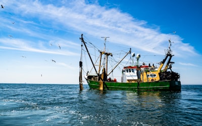
Indonesia, the world's largest archipelago, faces a monumental challenge in managing its more than six million square kilometers of jurisdictional waters. With a fishing fleet of more than 9,000 large vessels and extractive activity stretching from the Indian Ocean to the Pacific, authorities have come to understand that the mere presence of patrol boats is not enough to combat illegal fishing. The solution has come from space: a digital surveillance ecosystem that integrates satellite data, ship monitoring systems (VMS), geospatial analytics, and artificial intelligence algorithms. This paradigm shift has not only made it possible to detect infringements that would have previously gone unnoticed, but has also redefined the very concept of fisheries control.
The transformation is so profound that, today, a vessel that deviates slightly off course off the coast of Java can be identified as suspicious before any inspector comes on board. Each movement generates a fingerprint that automatic systems compare with permits, authorized fishing areas, and historical patterns. Within minutes, the software issues an alert. Surveillance capacity is no longer limited by the number of patrol boats available, but by the power of the technological infrastructure that processes terabytes of information. This new model of ocean governance represents a huge opportunity for technology companies that understand the challenges of the sector. .
From reaction to prediction
Historically, law enforcement at sea has been reactive. An offending ship was only detected if a patrol boat spotted it, leaving huge areas unchecked. The advent of satellite monitoring systems changed this dynamic. Indonesia required all fishing vessels, including medium-sized ones, to carry active VMS transmitters. By 2026, nearly 9,400 vessels were connected. The data generated not only reveals the position in real time, but also allows routes to be reconstructed, suspicious blackouts from transmitters to be detected and information to be cross-referenced with radar images and optical sensors. The result is a fisheries intelligence system that operates 24 hours a day, seven days a week.
The real qualitative leap, however, lies in the predictive capacity. Instead of waiting for a breach to occur, algorithms can identify risky behavior—such as unusual speed near a maritime border or intermittent transmitter deactivation—and prioritize inspecting those vessels. This approach, based on artificial intelligence for companies, makes it possible to optimize scarce resources and increase the effectiveness of patrols. To achieve this, government agencies need bespoke applications that integrate disparate sources: satellite data, administrative records, local fisher reports, and historical movement patterns. This is where companies like Q2BSTUDIO bring their expertise in developing modular and scalable platforms.
The Technology Architecture Behind Surveillance
Implementing a digital fisheries control system requires a robust infrastructure that combines mass storage, real-time processing, and advanced analytics. AWS and Azure cloud service solutions are critical to handling the massive amount of data generated by sensors. Each vessel sends its position every few minutes; Added to that are satellite images, weather data and reports from other sources. Hosting all that information in the cloud allows you to scale according to demand and ensure availability even in remote regions. In addition, business intelligence service tools, such as Power BI, make it easy for decision-makers to visualize activity patterns and generate executive reports.
However, technology is not limited to data collection. To transform those terabytes into useful information, tailor-made software with algorithms trained specifically for the Indonesian maritime context is required. AI agents can analyze trajectories in real time, identify anomalies and even predict areas at high risk of illegal fishing. Artificial intelligence also makes it possible to process satellite images to detect vessels that have turned off their transmitters, a common practice among offenders. This level of automation not only speeds up detection, but frees up human staff for tasks of greater strategic value.
Security and digital sovereignty challenges
As fisheries surveillance becomes more reliant on computer systems, new vulnerabilities emerge. Cybersecurity becomes a critical pillar. An attack that compromises vessel position data or manipulates alerts could paralyze control operations, allowing illegal vessels to act undetected. Indonesian authorities have begun to invest in perimeter protection and data integrity, but the responsibility also lies with technology providers. To ensure the reliability of the system, it is necessary to carry out regular audits, penetration tests and have incident response plans in place. In this context, companies that offer specialized cybersecurity services, such as Q2BSTUDIO, can help design resilient architectures that preserve trust in data.
Another challenge is the constant adaptation of offenders. When monitoring systems become more effective, illegal actors look for ways to circumvent them: temporarily disable transmitters, use flags of convenience, manipulate electronic documents, or even employ phishing techniques. This generates a technological arms race where each improvement in surveillance causes a new evasion strategy. To keep up, systems must be flexible and allow for the integration of new data sources, such as reports from synthetic aperture radar (SAR) satellites or open-source intelligence (OSINT).
The role of tech companies in ocean governance
Indonesia's experience shows that digital surveillance does not replace physical presence at sea, but rather empowers and reorients it. Patrol boats no longer sail blindly; now they go directly to the points indicated by the algorithms. This new data-driven enforcement model requires an ecosystem of technology partners capable of providing everything from cloud infrastructure to machine learning models. Q2BSTUDIO, with its focus on bespoke application development and expertise in artificial intelligence for enterprises, is uniquely positioned to collaborate with governments and international organizations on the implementation of fisheries monitoring platforms, as well as on the creation of cybersecurity solutions and business intelligence services that turn data into operational decisions.
The integration of AWS and Azure cloud services enables agencies to manage large volumes of information with predictable costs and high availability. In addition, dashboards developed with Power BI make it easier to communicate results to management levels and citizens. But beyond the tools, what is crucial is the ability to design a system that evolves at the same pace as the threats. The future of ocean governance lies in the creation of intelligent, decentralised and secure surveillance networks, where each sensor contributes its piece to the global puzzle.
Lessons for the rest of the world
What is happening in Indonesia is not an isolated case. Countries such as Chile, Norway and Australia are already exploring similar models. The trend is clear: the ocean is becoming transparent. Satellite data, combined with automated analysis, is removing the opacity that for centuries allowed illegal fishing. However, with this transparency comes responsibilities. The legitimacy of the sanctions imposed will depend on the quality of the data and the transparency of the algorithms. If a ship is fined because an AI system flagged it, the shipowner has the right to know the criteria used. Algorithmic accountability is a debate that is just beginning.
In this context, public-private collaboration is essential. Authorities need agile development teams that understand both maritime regulations and the latest trends in custom software. Q2BSTUDIO offers that combination of technical expertise and business acumen, helping to build the systems that will enable sustainable and legal fishing in the 21st century. Digital surveillance is not a luxury; It is an operational necessity for any nation that wishes to protect its marine resources. And as the Indonesian experience shows, when technology aligns with political will, the results can be transformative.
To dive deeper into how artificial intelligence is redefining the control of maritime activities, we invite you to explore our AI solutions for companies and discover how bespoke software can be tailored to your organization's specific needs. Also, if your organization requires a scalable and secure infrastructure, check out our AWS and Azure cloud service options. The ocean governance of the future is built today, with data, algorithms, and the collaboration of committed technology partners.