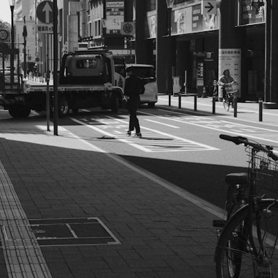
Assisted navigation for visually impaired people has advanced significantly thanks to artificial intelligence and the development of custom software applications that integrate visual perception models. However, one of the most critical challenges remains accurate and safe segmentation of sidewalks and roads in real time from a mobile device. An error in this task can lead a blind or low-vision person into dangerous areas, such as active traffic lanes. Therefore, the technology industry and research centers are combining deep learning techniques, synthetic data generation, and automatic labeling to build robust systems deployable on limited hardware.
The traditional semantic segmentation approach, based on generic urban datasets such as Cityscapes or Mapillary, does not adequately capture the pedestrian perspective at chest height. To address this, new datasets like the aforementioned SENSATION-DS collect images from a pedestrian viewpoint, labeling nine navigation-relevant classes: sidewalk, road, curb, grass, tree, vehicle, pedestrian, bicycle, and others. This taxonomy allows training models that more reliably distinguish the boundary between the safe zone (sidewalk) and risk zones (road).
From a technical perspective, segmentation architectures must balance accuracy, speed, and energy consumption. Models like UPerNet with MobileNetV3 backbone or DeepLabV3Plus with MobileNetV3 have been evaluated in offline scenarios and on real Android devices. Common metrics such as mIoU (mean Intersection over Union) are important but not sufficient. Specific safety indicators are needed, such as the 'Road-as-Sidewalk' error rate, which measures dangerous false positives. A model may achieve high mIoU but occasionally classify a road as sidewalk, which is unacceptable in an assistive system.
To improve robustness, domain adaptation techniques using mask-conditioned synthetic images generated with rendering engines like Blender or Unity are applied. Additionally, pseudo-labels generated by Segment Anything Model 2 (SAM2) allow labeling large volumes of data without manual annotation, reducing costs and accelerating development. In experiments, the combination of synthetic augmentation and SAM2 pseudo-labels significantly reduced the Road-as-Sidewalk error rate, albeit with a slight drop in overall mIoU. This demonstrates that safety-oriented optimization may require sacrificing some global accuracy to minimize critical risks.
Mobile deployment imposes constraints on memory, latency, and performance. DeepLabV3Plus-MobileNetV3 achieved 7.383 FPS at 512x384 resolution on a mid-range Android device, acceptable performance for real-time applications. However, energy efficiency and compatibility with hardware accelerators (NPU, GPU) are key factors. Commercial solutions must also integrate cybersecurity mechanisms to protect location data and captured images, as well as ensure the model is not vulnerable to adversarial attacks that alter segmentation. In this regard, cloud services like AWS or Azure enable scaling training and hybrid inference, while Business Intelligence platforms (Power BI) help monitor system performance in production.
At Q2BSTUDIO, as a company specialized in artificial intelligence and software development, we tackle these challenges by combining knowledge in computer vision, model optimization for edge computing, and cloud-native architectures. Our team designs custom applications that integrate safe segmentation models, using data augmentation and pseudo-labeling techniques to adapt to real urban environments. Additionally, we offer cybersecurity services (pentesting, API protection) to safeguard system integrity, and cloud consulting on AWS/Azure to deploy training pipelines and continuous model updates. The incorporation of AI agents allows, for example, the system itself to detect when segmentation is uncertain and request remote intervention or activate more conservative navigation modes.
For the accessible mobility sector, collaboration with end users (visually impaired people) is essential. Technical metrics must be validated with usability and real safety studies, measuring not only segmentation accuracy but the confidence and autonomy it generates in the pedestrian. Companies that invest in this type of technology not only comply with accessibility regulations but also open an emerging market for digital assistive solutions. The future trend points to multimodal models that also integrate depth sensors, ultrasound, or collaborative map data, all managed from cloud platforms with Big Data and BI capabilities.
In summary, safe sidewalk and road segmentation for mobile-assisted navigation is a field where technical excellence must align with social responsibility. The combination of lightweight architectures, synthetic data, pseudo-labels, and safety-oriented metrics enables building deployable smartphone systems that offer a reliable experience. If your organization seeks to implement an assisted navigation solution or improve the visual perception of its mobile applications, partnering with a technology provider like Q2BSTUDIO, which integrates AI, cloud, cybersecurity, and Business Intelligence, is the first step toward a robust and scalable product.