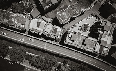
Remote sensing scene classification is an increasingly relevant field for the development of smart cities and land management. With the exponential growth of satellite and aerial imagery, artificial intelligence algorithms must be able to distinguish between categories such as residential, industrial, agricultural, or forested areas, often facing high intra-class variability and great inter-class similarity. This is where models like DMFNet, a dual-backbone architecture with multiscale fusion and spatial attention, demonstrate significant progress. This article provides an in-depth analysis of how this network improves accuracy in urban classification and how companies like Q2BSTUDIO can implement similar solutions for geospatial analysis and urban planning projects.
DMFNet is based on the extraction of hierarchical features through two pre-trained networks that capture complementary information. Multiscale fusion with residual propagation allows features from different resolutions to be combined efficiently, while a spatial attention module highlights the most informative regions in multi-object scenes. This combination achieves an average accuracy of 97.46% on the AID dataset, surpassing many previous approaches. But beyond the numbers, the interesting aspect is how this architecture can be adapted to specific business needs.
In the current context, where cities generate enormous volumes of data, having custom software that integrates AI models like DMFNet is key to making informed decisions. For example, a municipality could use a land-use classification system to optimize waste collection, plan new green areas, or detect unauthorized changes in buildings. Implementing these systems requires not only a powerful model but also a robust cloud infrastructure. This is where Q2BSTUDIO’s expertise in artificial intelligence and AWS/Azure cloud services comes into play, enabling scalable and secure model deployment.
The DMFNet architecture is particularly interesting for companies that need to classify large volumes of aerial imagery with high precision. Its dual backbone allows feature extraction at different abstraction levels, crucial when scenes contain very diverse elements, from small buildings to large infrastructures. Multiscale fusion with residuals ensures that low-resolution information is not lost when combined with fine details, improving model robustness. Additionally, spatial attention acts as an intelligent filter that ignores background noise and focuses on relevant objects, reducing false positives. From a technical perspective, implementing DMFNet or similar models can be done using deep learning frameworks like PyTorch or TensorFlow. However, integration into a complete software product requires additional skills in backend development, APIs, databases, and frontend. Q2BSTUDIO offers custom software development services covering the entire project lifecycle, from conceptualization to cloud deployment.
Process automation is another relevant aspect. With DMFNet, it is possible to create AI agents that periodically analyze new images and generate alerts for significant territorial changes. These intelligent agents can be integrated into municipal or enterprise management systems, facilitating continuous monitoring. Q2BSTUDIO develops such AI agents, combining computer vision models with business logic to deliver complete solutions. Furthermore, the company integrates cybersecurity capabilities to protect sensitive data from satellite imagery, and Business Intelligence solutions with Power BI to visualize classification results in interactive dashboards. Visualizing results is essential for non-technical users to interpret data. With Power BI, it is possible to create panels showing class distribution on a map, temporal evolution of land-use changes, or anomaly alerts.
DMFNet’s two-stage training approach, with initial backbone freezing followed by selective fine-tuning, is a recommended practice to avoid overfitting and improve generalization. This technique is especially useful when dealing with limited datasets, a common situation in business projects. Q2BSTUDIO applies similar methodologies in its AI projects, ensuring robust and transferable models across different domains. In business terms, urban classification through AI opens opportunities in sectors such as real estate, precision agriculture, logistics, and defense. For instance, an insurance company could use image analysis to assess flood or fire risks in different areas. A construction firm could automatically monitor project progress. For all these applications, having a technology partner like Q2BSTUDIO, which understands both the algorithmic side and software engineering, is a competitive advantage.
The cloud plays a fundamental role. Deep learning models require substantial computational resources for training and inference. AWS and Azure offer GPU instances and managed services like SageMaker or Azure Machine Learning. Q2BSTUDIO advises on the most suitable cloud infrastructure, optimizing cost and performance. Additionally, it implements CI/CD pipelines to update models without disruptions. Finally, cybersecurity must not be overlooked. Satellite imagery may contain sensitive information about critical infrastructures. Q2BSTUDIO includes security measures such as encryption, access control, and pentesting in its projects, ensuring data and models are protected against threats.
In conclusion, DMFNet represents an advancement in remote sensing scene classification, but its true value materializes when integrated into business solutions. The combination of AI, cloud, custom software, and cybersecurity enables organizations to fully leverage geospatial information. Q2BSTUDIO, with its experience in software development and technology, is the ideal ally to bring these models from the lab to production, generating real impact in urban management and beyond.