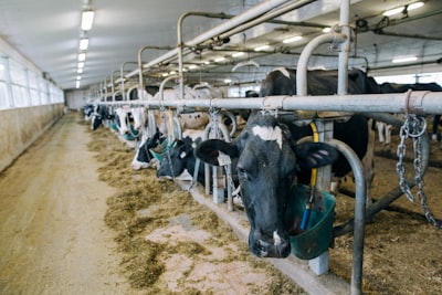
Detecting dairy farms from satellite imagery presents a technical challenge that combines spatiotemporal analysis, machine learning, and open geographic data. Unlike other crops or infrastructure, dairy farms do not always show a clear visual footprint: their evidence is distributed across seasonal pastures, field boundaries, roads, buildings, and vegetation patterns that vary throughout the year. Moreover, labeled farm datasets are often incomplete or inaccurate, making traditional supervised approaches difficult. In this context, a weakly supervised approach—which combines label-free learned representations with weak geographic priors—allows reducing massive satellite image collections into compact candidate sets ready for human review.
Recently, a study on County Cork, Ireland, demonstrated how aligning spring, summer, and autumn Sentinel images, along with spectral, vegetation, and built-area indices, can generate multi-season embeddings using a Barlow Twins architecture. This encoder learns transformation-invariant representations without farm labels. In parallel, weak OpenStreetMap (OSM) priors are used to build a rule-based score that combines proximity to known farms, seasonal grazing evidence, and summer greenness. This score is then smoothed over a spatial representation graph that integrates geographic proximity and embedding similarity, grouping high-scoring tiles into ranked candidate clusters.
Results on 26,722 valid tiles showed that with only 535 high-confidence tiles grouped into 71 clusters, the top five achieved 60% precision within 500 meters and 80% within 1,000 meters relative to held-out OSM farms. This methodology proves that seasonal representation learning coupled with weak geographic priors can become an operational tool for farm detection over large regions, drastically reducing manual inspection effort and accelerating decision-making in the agricultural sector.
At Q2BSTUDIO we understand that such projects require combining advanced artificial intelligence capabilities, large-scale geospatial data management, and a robust cloud architecture. That is why we offer custom software development that integrates AI models like Barlow Twins encoders, tailored to each client's specific needs. Our experience in cloud computing with Azure and AWS cloud services enables scalable, secure, and cost-effective satellite processing pipelines. Furthermore, cybersecurity is a fundamental pillar in protecting sensitive agricultural data—from imagery to farm coordinates—so we embed cybersecurity practices in every development phase.
Weakly supervised detection of dairy farms from satellite is a clear example of how artificial intelligence can transform precision agriculture. By combining self-supervised learning, open data, and domain rules, a balance between accuracy and operational cost is achieved. At Q2BSTUDIO we work with Business Intelligence (BI) and Power BI solutions to visualize candidate clusters and their metrics, facilitating field team decision-making. We also explore AI agents that, based on language models and reasoning, can automate part of the candidate review process, prioritizing those most likely to be active farms.
The future of farm detection lies in systems that continuously learn from each new satellite image and human feedback. Weakly supervised pipelines, like the one described, are the gateway to an ecosystem where cloud technology, AI, and custom software combine to deliver practical and scalable tools. At Q2BSTUDIO we help agricultural organizations, governments, and technology companies implement these capabilities, ensuring innovation reaches the field efficiently and securely.