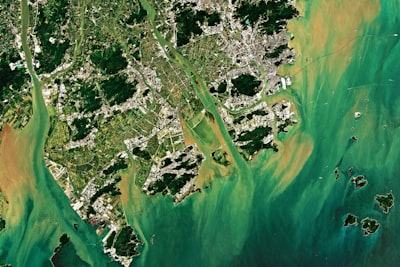
Accurately measuring urban carbon emissions has become a critical challenge for governments and corporations committed to sustainability. Conventional approaches based on fixed-source inventories or statistical models often fail to capture the real dynamics of cities due to the lack of detailed local data. Satellite observation offers global coverage, but its predictive capacity is limited by the absence of semantic and temporal context. In this scenario, CarbonCLIP emerges as an innovation that integrates artificial intelligence and multimodal learning to overcome these limitations, combining satellite images with textual descriptions generated from street-level photographs using large language models (LLMs).
The core of CarbonCLIP is a task-oriented multimodal distillation framework that employs dual-branch contrastive learning. Unlike previous methods that treat satellite images as mere reflectance maps, this approach explicitly bridges the gap between the top-down satellite view and ground-level human activities. The spatial branch uses fine-grained textual descriptions automatically generated by large multimodal models (LMMs) from street-view images, providing semantic priors that reflect building functions, infrastructure, and urban activities. The temporal branch, for its part, incorporates a month encoder that models seasonal emission variation, such as heating peaks in winter or increases due to tourism in summer. Multimodal data is required only during the pretraining phase; at inference time, only satellite imagery is needed, enabling scalable deployment even when street-level data is unavailable.
CarbonCLIP’s architecture addresses a fundamental problem in remote sensing: data-source heterogeneity. LMMs extract semantic knowledge from street-view images —for example, identifying whether an area is residential, commercial, industrial, or mixed-use— and transfer it to the satellite representation through a contrastive alignment process. This means the model learns to associate visual satellite patterns with abstract concepts like 'high traffic density' or 'office zone,' improving predictive accuracy. Experiments conducted in Beijing and Singapore show that CarbonCLIP significantly outperforms baseline methods, validating the effectiveness of transferring multimodal knowledge into satellite representations. In Beijing, the reduction in mean squared error was 18% relative to the best competitor, while in Singapore the improvement reached 22% in coastal areas with high temporal variability.
This breakthrough opens high-impact opportunities in smart urban planning, carbon credit verification, and corporate environmental management. However, implementing an AI-based emission prediction system requires robust technological infrastructure. Q2BSTUDIO, as a company specialized in artificial intelligence and custom software development, can help organizations adapt frameworks like CarbonCLIP to their specific needs. Integrating heterogeneous data —satellite, street, time series— demands expertise in cloud computing on AWS and Azure, as well as process automation and Business Intelligence. For example, a Power BI dashboard could visualize real-time emissions estimated by the model, enabling sustainability officers to make informed decisions.
Beyond prediction, the scalability of CarbonCLIP depends on the ability to process large volumes of satellite images efficiently. This is where the cybersecurity and custom applications services offered by Q2BSTUDIO come into play. Protecting sensitive data —such as critical locations or activity patterns— is essential in corporate environments. Our pentesting and audit services ensure that data pipelines meet the highest security standards. Furthermore, developing AI agents that automate image acquisition, preprocessing, and anomaly alerts can drastically reduce operational costs. For instance, an agent could schedule weekly satellite image retrieval, run the model, and send automatic reports to stakeholders.
Another key aspect is customization. Each city has unique emission patterns influenced by its climate, industry, and mobility. Q2BSTUDIO offers consulting services to fine-tune model hyperparameters, add local data sources such as IoT sensors or traffic networks, and create user interfaces tailored to different profiles. Our experience in BI with Power BI transforms model outputs into interactive visualizations that facilitate trend detection and regulatory reporting. The combination of AI, cloud, and automation not only improves prediction accuracy but also democratizes access to high-resolution environmental information for businesses of all sizes.
The future of urban monitoring lies in models that, like CarbonCLIP, can learn from multiple sources and transfer that knowledge to a single input modality. This reduces dependence on costly local censuses and enables consistent global coverage. Q2BSTUDIO, as a comprehensive technology partner, can guide organizations through every stage: from problem definition to cloud production deployment. Whether for complying with emission regulations, optimizing corporate carbon footprint, or developing smart city solutions, our team combines data science, cloud engineering, and cybersecurity to deliver tangible results. If your organization is looking to implement an AI-based carbon prediction system, contact us to explore how we can collaborate.
In summary, CarbonCLIP represents a qualitative leap in satellite-based emission prediction by incorporating street-level semantics and temporal variability. Its multimodal distillation approach exemplifies how academic research can translate into practical tools. For businesses, having a partner that understands both data science and cloud infrastructure is essential. Q2BSTUDIO offers both capabilities, integrating artificial intelligence, cybersecurity, cloud, and BI to build robust and scalable solutions. The era of intelligent urban monitoring is here, and the combination of satellites, AI, and local knowledge will drive the transition toward more sustainable cities.